Surfer New Feature: 3D Digitization
Автор: Golden Software
Загружено: 2022-02-01
Просмотров: 4133
Описание:
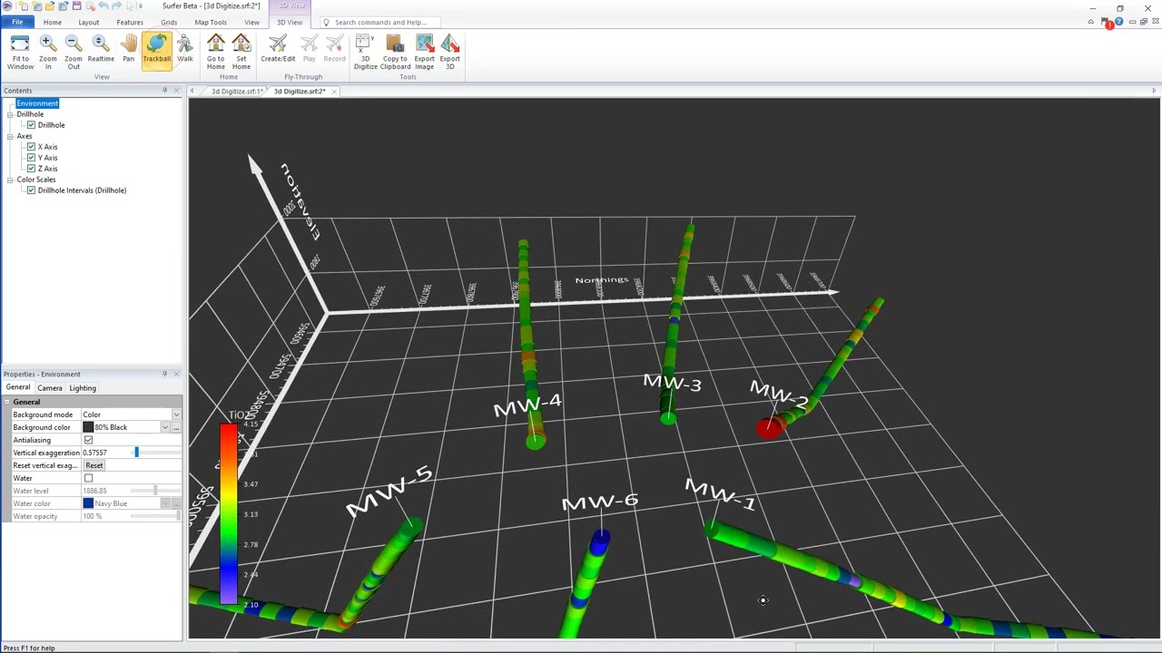
You can now perform digitization of data in the 3D view! 3D digitization collects XY and Z coordinates. You can use this new feature in a variety of functions, such as to obtain the XYZ coordinates of specific spot locations on a surface or points on subsurface drillhole paths.
This new feature works well with our new drillhole map. For example, when viewed in 3D, you can digitize specific locations at depth on each drillhole (e.g. the top of a unit or stratigraphic layer, determined by your displayed drillhole data). You can then go back to the 2D plot view, grid the digitized XYZ data, and add a contour layer from grid file to the existing drillhole map. The new surface will also be displayed in the 3D view with the drillhole paths!
Download the free trial at https://www.goldensoftware.com/produc...
Повторяем попытку...
Доступные форматы для скачивания:
Скачать видео
-
Информация по загрузке:


![Почему работает теория шести рукопожатий? [Veritasium]](https://image.4k-video.ru/id-video/ggI1xKzoANs)