Converting the Roads & Highways Advanced LRS to a Routable Network
Автор: Esri Events
Загружено: 2017-03-28
Просмотров: 3920
Описание:
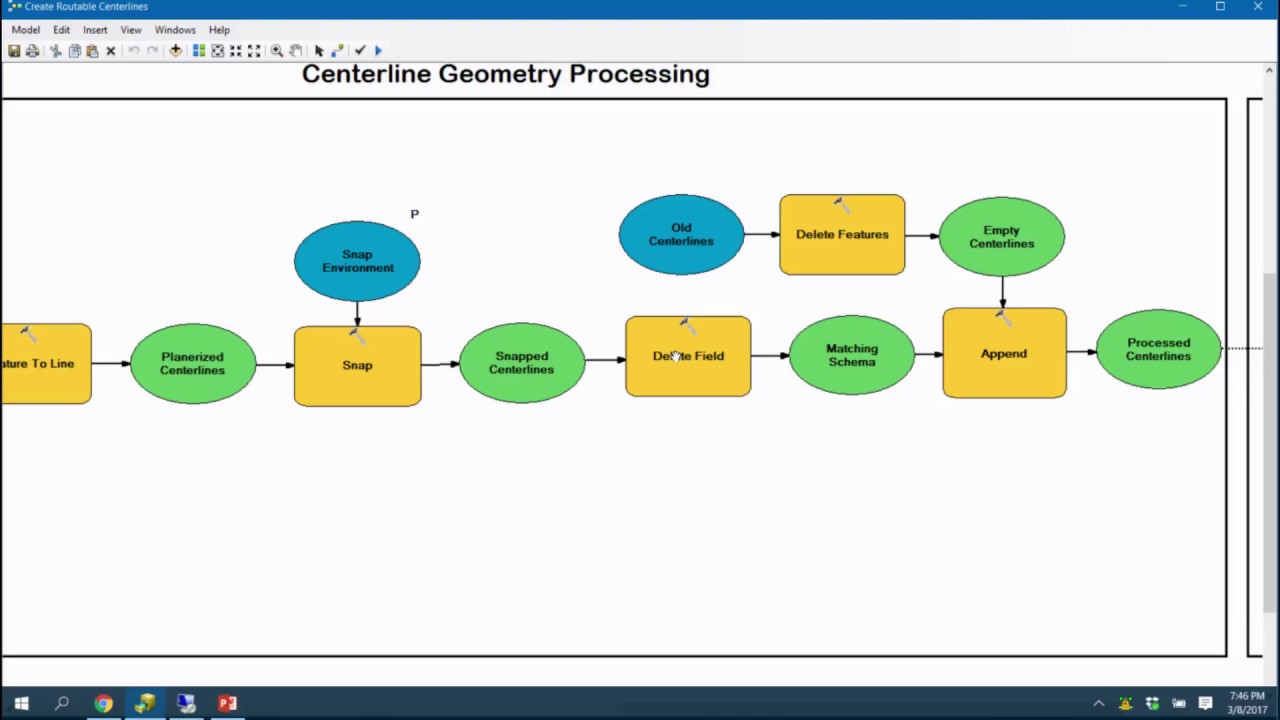
Roads & Highways allows organizations to manage roadway assets such as One Way Streets, Overpasses, Underpasses, Speed Limit, Turn Restrictions and Address Block Ranges. In this session you will learn how to use out of the box geoprocessing and python to convert these Roads and Highways Events into a routable network. We will also explore the use cases for these custom routable networks for use with Network Analyst route solvers, custom route packages for Navigator for ArcGIS and web based applications that utilize custom route solvers with network barriers representing construction projects in your Advanced LRS managed by Roads and Highways.
Presented by Eric Rodenberg
Повторяем попытку...
Доступные форматы для скачивания:
Скачать видео
-
Информация по загрузке:


