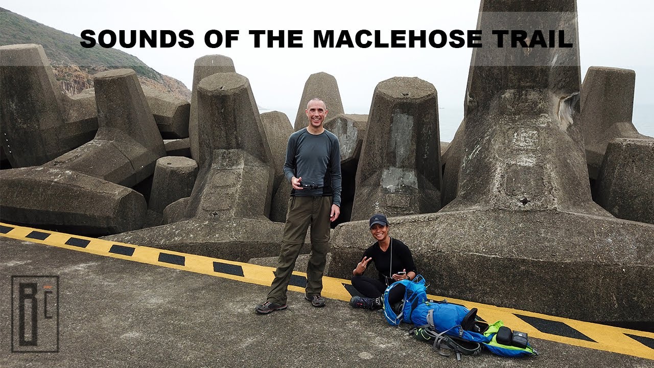
Sounds of the MacLehose Trail (Stages 1 & 2)
Автор: Boris & Cris • Everyday is an Adventure
Загружено: 2020-05-23
Просмотров: 69
Описание:
00:00:18 to skip Intro
Stage 1: Pak Tam Chung → Long Ke (10.6 km)
Stage 2: Long Ke → Pak Tam Au (13.5 km)
——————————————————————————————————————————————————
✔ SUBSCRIBE: Don't miss any new video ⇄ https://bit.ly/3s9lwEM (turn on notifications)
——————————————————————————————————————————————————
Editing Software: Apple Final Cut Pro
Camera & Video Recording Gear: Apple iPhone 11 Pro, Apple iPhone XS, DJI OSMO Pocket, DJI Mavic Pro
Music: Hide with Me ~ Ten Towers
Background Information: The MacLehose Trail (麥理浩徑) is a 100-kilometre hiking trail that crosses much of the New Territories, Hong Kong, starting from Pak Tam Chung, Sai Kung, in the east to Tuen Mun in the west. The path is marked by distance posts at 500-metre intervals. The trail is named after Sir Murray MacLehose, the longest-serving governor of Hong Kong, who established the Country Parks and was himself an enthusiastic hiker. The trail passes through a variety of natural scenery including beaches and mountains. The New Territories, through which the MacLehose Trail runs, covers the majority of Hong Kong's land area. The east coast, where the trail begins, is deeply indented and wild. The central mountains, which the MacLehose Trail crosses, include many of Hong Kong's highest peaks. The western part, where the trail winds to its end, features numerous valley reservoirs.Cited by National Geographic as one of the world’s 20 dream trails, this 100 km trekking route, known as the MacLehose Trail, showcases the impressive coastline of the eastern peninsula in Sai Kung. Along the trail you’ll see sea caves, sea stacks, and hexagonal rock columns. Toward the end of the trail’s Sai Kung section, you can listen to the sound of breaking waves on the beautiful beaches. High Island Reservoir was built in the 1970s across a narrow channel. It‘s worth taking a look: although it’s a man-made structure, it still blends in with the impressive geology of its surroundings. The area near the East Dam is also the gateway to the many treasures of the Hong Kong UNESCO Global Geopark. Walking along the High Island Geo Trail, you’ll pass by the magnificent 100-metre-tall hexagonal rock columns that dominate the area near the East Dam. You shouldn’t miss these geological wonders up close, and the trail offers some of the best vantage points. We also recommend checking out the large sea cave and Po Pin Chau, which is a sea stack further down the coast. As an interesting side note: ‘Po Pin' means 'riven' or 'split' in Cantonese. Take the trail to Long Ke, a white sand beach with emerald waters. Next, there is a challenging climb up Sai Wan Shan. At 314 metres, it offers photo-perfect beach vistas. Along the trail, you’ll soon reach the scenic beaches of Sai Wan and Ham Tin. Further along, you’ll pass through the hidden 200-year-old village of Chek Keng on a serene inlet. Keep going until you reach Pak Tam Au, where you can see Ko Tong Hau and Wong Shek Pier in the distance. This is the end of Section Two of the MacLehose Trail. The Sai Kung District (西貢區) is one of the 18 districts of Hong Kong. Hong Kong itself is a special administrative region of China. The district comprises the southern half of Sai Kung Peninsula and Clear Water Bay Peninsula in the New Territories plus a strip to the east of Kowloon.
#asia #hongkong #maclehosetrail #travel #adventure
Повторяем попытку...
Доступные форматы для скачивания:
Скачать видео
-
Информация по загрузке: