Montana Snowpack Update, Drought Concerns & La Niña Outlook | Weather Wednesday Jan 28th
Автор: Meteorologist Jason Laird
Загружено: 2026-01-28
Просмотров: 201
Описание:
Welcome to Weather Wednesday for January 28th — your Clear Source Forecast focused on what matters most across Montana.
In this update, we take a detailed look at snow water equivalent percentages statewide and what current snowpack levels mean moving forward. While overall snowpack isn’t bad when factoring in water equivalent, some regions are struggling — including the Bear Paw Mountains, currently at just 56% of normal.
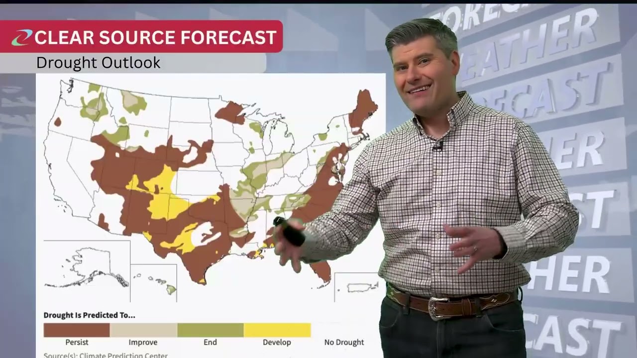
Drought conditions remain a key concern, especially in Chouteau and Teton Counties. With significant wheat production in this area, persistent dryness could have real impacts as we head toward spring.
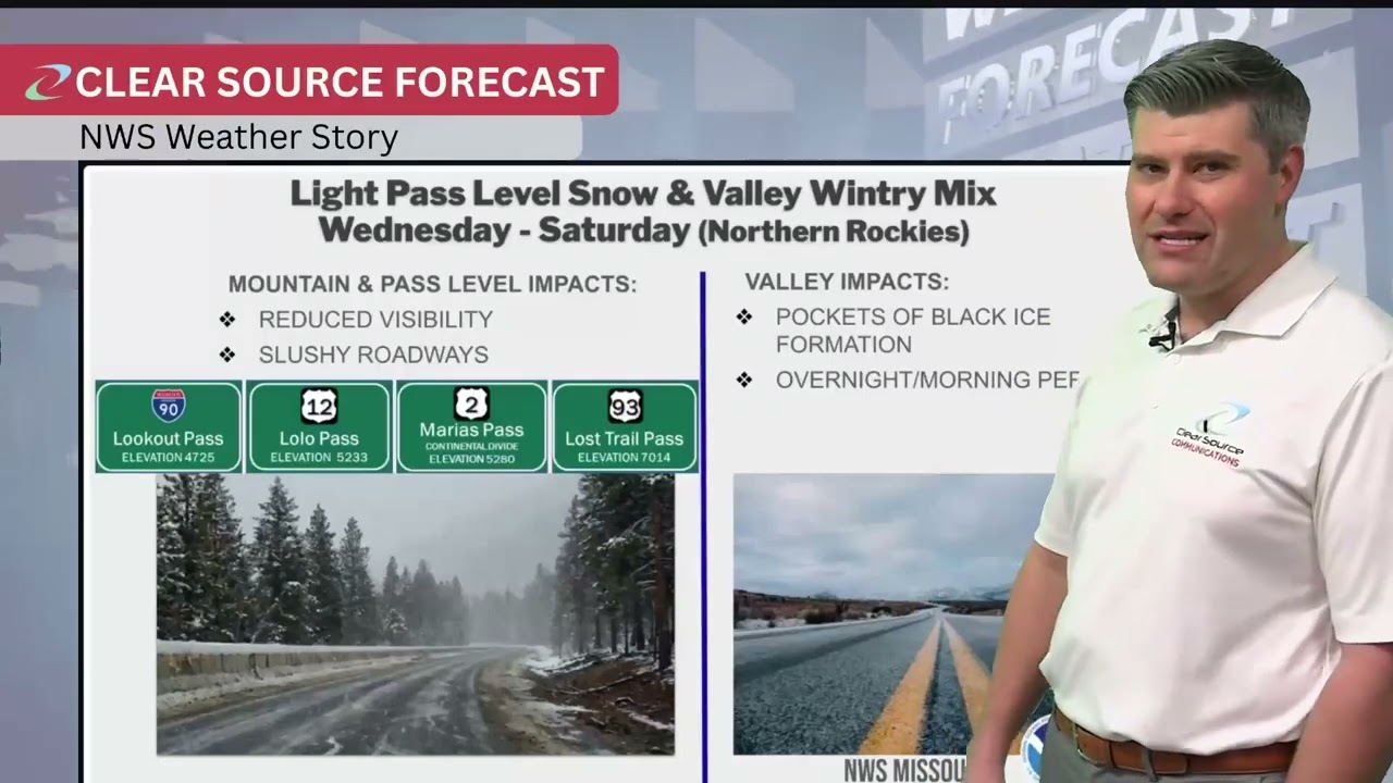
We also break down National Weather Service updates for Great Falls, Billings, Glasgow, and Missoula. A stationary front remains locked across central Montana, bringing light mountain flurries both west and east, with little movement expected over the next few days.
Temperatures remain mostly near average statewide, with central Montana running slightly above normal. Looking ahead, long-range outlooks continue to favor below-average temperatures and above-average precipitation for February, March, and April. We also discuss how fading La Niña conditions and the Pacific Decadal Oscillation could influence a colder, wetter pattern — though meaningful changes may not fully settle in until closer to March.
If Montana weather impacts your work, travel, or livelihood, this is a forecast worth watching.
Subscribe for weekly Weather Wednesday updates and drop a comment with what you’re seeing in your area.
Повторяем попытку...
Доступные форматы для скачивания:
Скачать видео
-
Информация по загрузке: