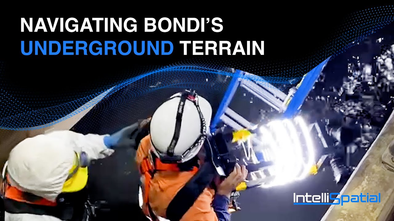
Navigating Bondi's Underground Terrain and Innovative Survey Solutions
Автор: ISGroup
Загружено: 2025-06-19
Просмотров: 284
Описание:
Navigating Bondi's Underground Terrain and Innovative Survey Solutions (2023)
Delving into the depths of the Bondi Wastewater Treatment Facility, our team at IntelliSpatial recently navigated the challenges of this 150-year-old underground marvel.
Journeying through complete darkness and confined spaces, we devised innovative solutions, including the development of specialised backpacks and a remote controlled car equipped with imaging technology. These solutions allowed us to capture intricate details, offering our client a comprehensive full dimensional mesh that pinpointed defects such as water ingress and cracks.
External UAV surveys with LiDAR ensured a comprehensive view, addressing risks such as rockfalls on cliff face exits.
The project showcased the power of diverse survey technologies, illuminating every corridor and demonstrating our commitment to innovation in achieving optimal outcomes for our clients.
#Innovation #Surveytechnologies #Infrastructure #Engineeringexcellence #intellispatial #isgroup
Video Transcription:
The Bondi Wastewater Treatment Facility is a mind blowing facility. The underground comprises of a number of different tunnels, different lengths and then various plants to process sewage from all over Sydney. To maintain a facility that's 150 years old the client requires a very intimate knowledge of the condition of the facility so that they can do targeted maintenance.
Being underground, a lot of the tunnels are in complete darkness, no lights whatsoever. We are talking about spaces that rarely gets accessed by humans. When we look at some of those tunnels and surfaces, no one's actually seen those surfaces in ten years or more. It's an unconventional site that required quite a wide variety of survey technologies and techniques to get all the data captured.
Some of the unique challenges we faced on this site was confined spaces, tunnels. It's a sewage treatment facility, so there was an odd smell in places. To make this work we came up with a number of unique solutions. We had to basically design specific backpacks that allowed us to capture from several different imaging devices at the same time.
In another part of the tunnel network, we used a remote control car, with an imaging device mounted to the car. This was to capture some of the more difficult parts of the facility.
Our technology allowed the client in a full dimensional mesh, highlighting every single defect, you know, water ingress, cracks.
We included external high resolution UAV surveys with both LIDAR and imaging devices.
When we started piecing together the different parts of the survey. It was actually amazing to see how everything sat in relation to each other. So we have the different sections of the tunnels that we surveyed together with the cliff face, together with the above ground treatment facility that got surveyed and just to see the entire thing and be able to navigate through this complex maze in our portal was just amazing.
The parts that were in complete darkness was now as if the sun was shining inside those corridors. This was a good example of using many different survey technologies to achieve the best possible outcome for our client.
Повторяем попытку...
Доступные форматы для скачивания:
Скачать видео
-
Информация по загрузке: