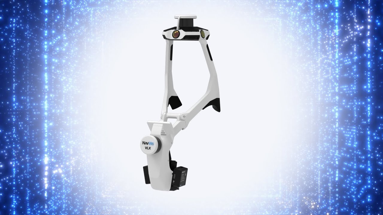
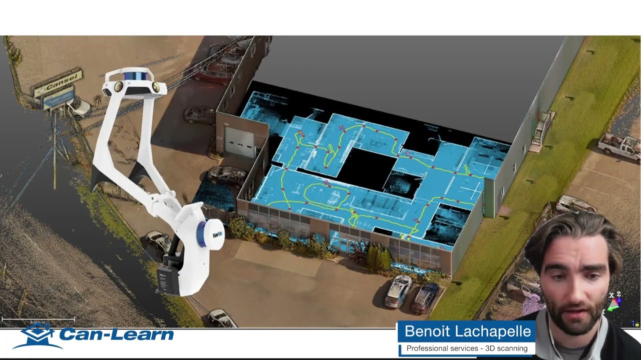
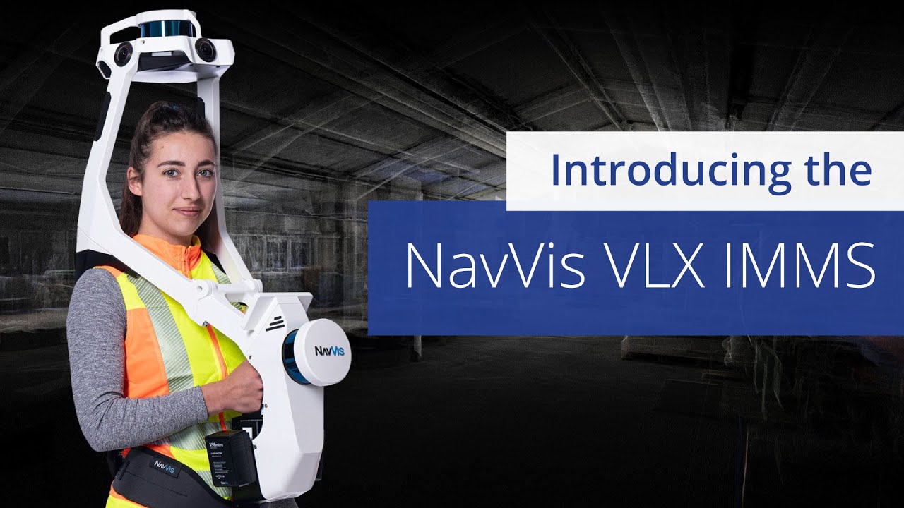
Introducing the NavVis VLX Indoor Mobile Mapping System (IMMS)
Автор: Colliers Engineering & Design
Загружено: 2022-08-19
Просмотров: 1404
Описание:
There’s a tool for every job, and our geospatial professionals just added the NavVis VLX indoor mobile mapping system (IMMS) to their toolset. The IMMS is a transportable, end-to-end, reality capture solution that delivers survey-grade point clouds, enabling us to scan and store every detail about a building simply by walking through the space.
Learn how the NavVis VLX indoor mobile mapping system (IMMS) can work for your project https://colliersengineering.com/navvi...
Follow us on Twitter ► / collierseng
Connect with us on LinkedIn ► / colliers-engineering
Like us on Facebook ► / colliersengineering
Follow our Instagram ► / colliersengineering
Повторяем попытку...
Доступные форматы для скачивания:
Скачать видео
-
Информация по загрузке: