Exploring Montauk's State Parks - Eastern End of Long Island, New York
Автор: Dennis Louie
Загружено: 2024-08-07
Просмотров: 1238
Описание:
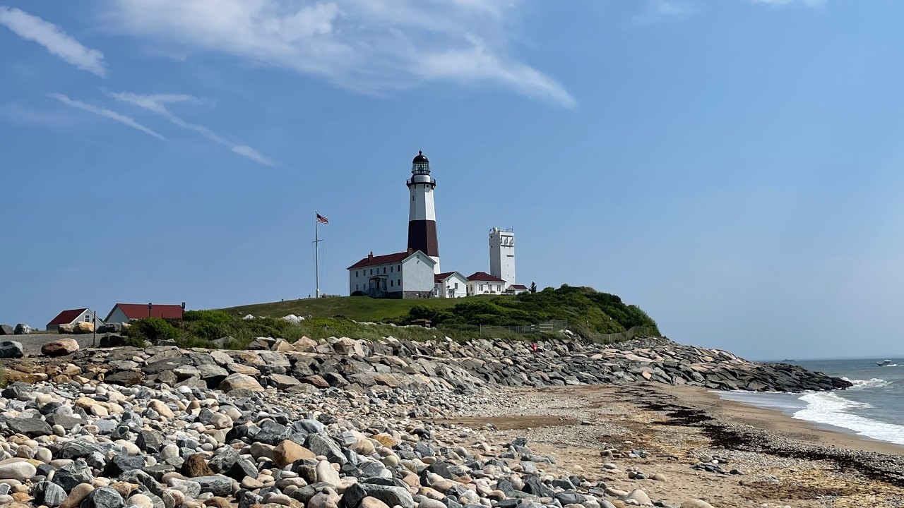
Welcome to Montauk, the Easternmost Point in Long Island, NY! It is roughly 118 miles east of Midtown, Manhattan. This video explores 3 of the 6 state parks being: Montauk Point State Park, Camp Hero State Park & Shadmoor State Park. I also explore the beaches, wildlife and bluff lookouts along the shoreline! I recommend giving this place a visit if you can! Enjoy the video tour!
Highlights:
0:00 Intro
0:29 How to Travel to Montauk? (Via Car & LIRR/Commuter Rail)
3:39 Montauk History
4:55 Vantage Point of the Atlantic Ocean
6:22 Rocky Shoreline Near the Lighthouse
7:12 Montauk Point Lighthouse
13:05 Turtle Cove Shoreline
14:47 Camp Hero State Park
18:02 Camp Hero Radar Tower (AN/FPS-35)
19:28 Camp Hero Bluff Lookout
20:35 Wildlife (Bunny & Deer)
22:11 Shadmoor State Park
24:04 NY Route 27 - Reference Marker (Bonus)
27:16 Conclusion
References:
The I-495, Southern State Pkwy, NY-27, NY-27A & Suffolk County Route 111 shields comes from Wikipedia.
The Belt Pkwy signs comes from: https://www.specialmoderndesign.com/p...
The LIRR information and maps is from the MTA (Metropolitan Transportation Authority)
Montauk Fishing History is from: https://fishingbooker.com/blog/fishin...
History of Montauk, Montauk Point Lighthouse, Camp Hero State Park, Camp Hero Radar Tower & Shadmoor State Park is taken from Wikipedia.
Other maps used in this video come from Google Maps and Wikimedia Maps
Filmed: August 1, 2024
Повторяем попытку...
Доступные форматы для скачивания:
Скачать видео
-
Информация по загрузке:


![[4K] Long Island CHRISTMAS WALK🎄Oyster Bay, NY](https://image.4k-video.ru/id-video/CfVz2YSDxnI)


![Top 10 Best Things to do in Montauk, Long Island, New York [Montauk Travel Guide 2025]](https://image.4k-video.ru/id-video/ubHnhSwPv78)

