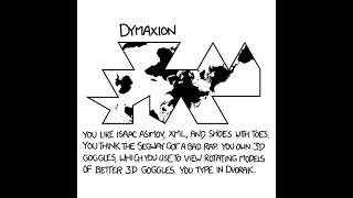
17 map projections and how they distort the shape and size of countries
Автор: Reanimated Science
Загружено: 2020-03-27
Просмотров: 13320
Описание:
It's impossible to flatten a globe without at least some distortion. There exists so many map projections because they all optimize for different things: Some for easy ship navigation, some for true land sizes, some for accurate shapes, while others minimize distortions through compromise.
The map projections shown in this video are: Equirectangular, Lambert, Mercator, Mollweide, Hammer, Bottomley (at 30 degrees), Sinusoidal, Werner, Bonne (at 45 degrees), August, Collignon, Eckert 1&3&5, Fahey, Foucaut, and Lagrange.
Map data from Natural Earth: https://www.naturalearthdata.com/
Source code: https://github.com/Lemmih/reanimate/t...
Animation software: https://github.com/Lemmih/reanimate
Повторяем попытку...

Доступные форматы для скачивания:
Скачать видео
-
Информация по загрузке: