Google Earth to Civil 3D Using AI | GPSVisualizer KML to Surface in civil 3D
Автор: Route Crafter
Загружено: 2025-12-21
Просмотров: 43
Описание:
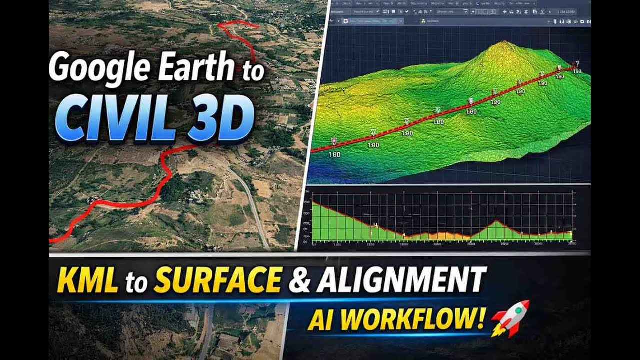
In this video, I demonstrate a complete and practical workflow to convert Google Earth data into AutoCAD Civil 3D using GPSVisualizer with AI-assisted processing. This method is especially useful when field survey data is limited, delayed, or unavailable and you need a quick, workable base for planning or preliminary design.
You will learn how to:
Extract accurate location data from Google Earth
Export KML files correctly (most people mess this up)
Process, clean, and convert KML data using GPSVisualizer
Handle elevation data and coordinate issues
Import processed data into AutoCAD Civil 3D
Create surfaces, alignments, and profiles
Understand the limitations of Google Earth data and where it should NOT be used
This workflow is ideal for:
Civil engineering students
Survey beginners
Freelancers working on concept or proposal-stage projects
Engineers who want to save time before final survey arrives
⚠️ Important Reality Check:
Google Earth data is not a replacement for ground survey. If you use it blindly for final design, you will make mistakes and pay for them later. Use this method only for preliminary planning and feasibility work.
By the end of this video, you will clearly understand:
When this method is useful
When it is dangerous
How to apply it correctly in real civil engineering workflows
If your goal is to work faster, smarter, and more professionally, watch the video till the end and apply the process properly.
Повторяем попытку...
Доступные форматы для скачивания:
Скачать видео
-
Информация по загрузке: