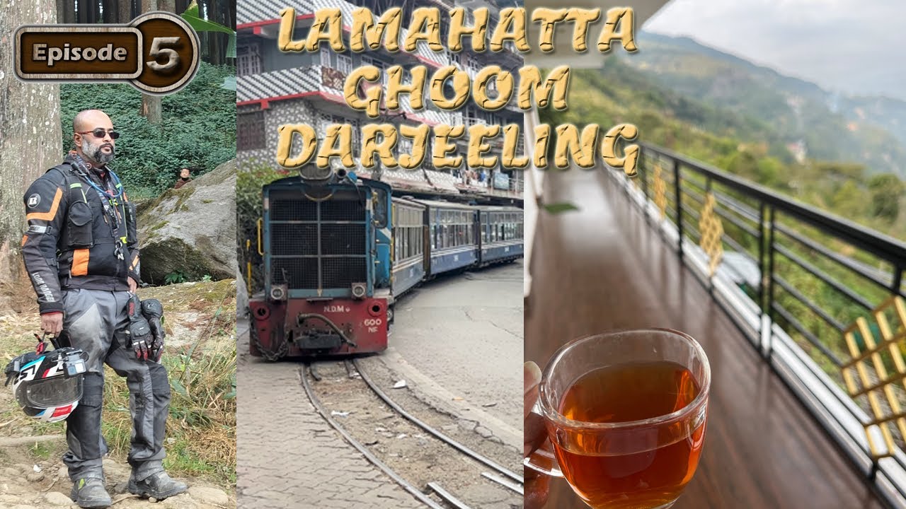
Lamahatta - Ghoom - Darjeeling || Sikkim & North Bengal Series || EP-5
Автор: Bangali BackPacker
Загружено: 2026-01-27
Просмотров: 120
Описание:
Lamahatta is a small village located 23km away from the main town Darjeeling. Surrounded by pine forest and a beautiful view of Mt Kanchenjunga this picturesque village has been developed as an eco-tourism place in late 2012. Lama in Lamahatta stands for Buddhist monk and Hatta for hut - a monk's hermitage. At an altitude of 6800 Ft. Lamahatta is a calm and peaceful place with Pine trees standing majestically with the looming Mount Kanchenjunga in the forefront. The Buddhist Prayer Flags fluttering at the slight breeze were 500 years old Buddhist Monastery is situated just 20 min. walks. The inhabitants are mostly tribal Buddhist people like Dukpas, Sherpa, and Yalmoos.
Ghoom (or Ghum) is a serene, high-altitude town in West Bengal, India, located 6 km from Darjeeling. Famous for hosting India's highest railway station (\(7,407\) ft) on the Darjeeling Himalayan Railway, it is renowned for its panoramic Himalayan views, the historic 19th-century Yiga Choeling Monastery, and the Batasia Loop.
Darjeeling (/dɑːrˈdʒiːlɪŋ/,[14] Nepali: [ˈdard͡ziliŋ], Bengali: [ˈdarˌdʒiliŋ]) is a city in the northernmost region of the Indian state of West Bengal. Located in the Eastern Himalayas, it has an average elevation of 2,045 metres (6,709 ft).[10] To the west of Darjeeling lies the easternmost province of Nepal, to the east the Kingdom of Bhutan, to the north the Indian state of Sikkim, and farther north the Tibet Autonomous Region of China. Bangladesh lies to the south and southeast, and most of the state of West Bengal lies to the south and southwest, connected to the Darjeeling region by a narrow tract. Kangchenjunga, the world's third-highest mountain, rises to the north and is prominently visible on clear days.
Повторяем попытку...
Доступные форматы для скачивания:
Скачать видео
-
Информация по загрузке: