Скачать
Namria releases updated map of West PH Sea, explains EEZ depiction | INQToday
Автор: INQUIRER.net
Загружено: 2026-02-18
Просмотров: 11859
Описание:
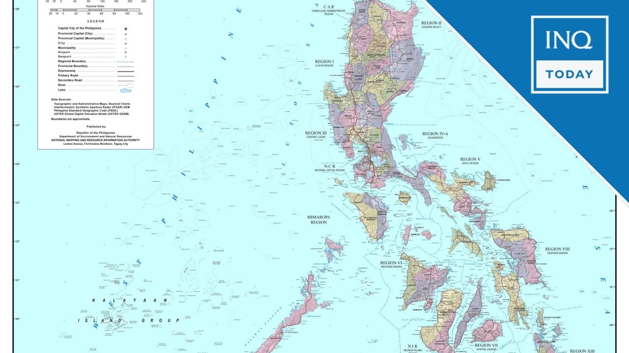
The National Mapping and Resource Information Authority releases an updated official map depicting the West Philippine Sea and the country’s maritime limits, saying the representation complies with domestic law and international standards.
Read more: https://inqnews.net/UpdatedWPSmap
Visit us at https://www.inquirer.net
Facebook: / inquirerdotnet
Twitter: / inquirerdotnet
Не удается загрузить Youtube-плеер. Проверьте блокировку Youtube в вашей сети.
Повторяем попытку...
Повторяем попытку...
Доступные форматы для скачивания:
Скачать видео
-
Информация по загрузке:


![ARMIA PUTINA DRUGĄ ARMIĄ ŚWIATA? PRAWDZIWA SIŁA ROSJI [WOLSKI I BOJKE]](https://imager.clipsaver.ru/-0hLR4R3gvk/max.jpg)