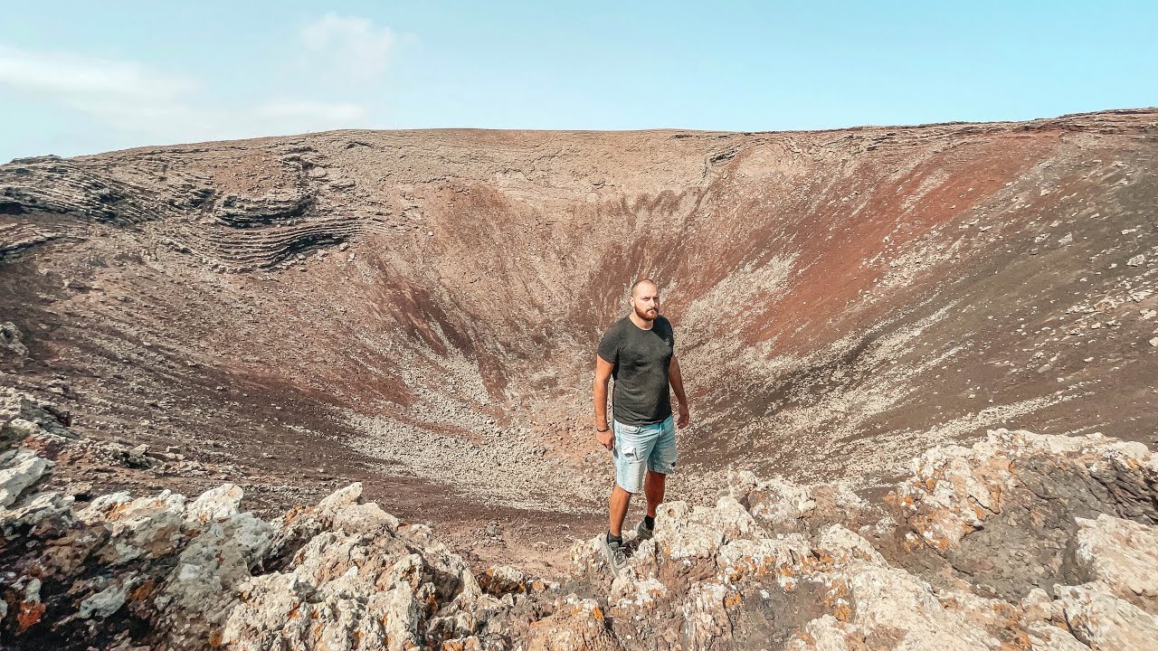
Fuerteventura's Calderón Hondo Is One Of The Most Accessible Volcanoes On The Island!
Автор: yourtravelwolf
Загружено: 2023-03-13
Просмотров: 1890
Описание:
Fuerteventura's Calderón Hondo Is One Of The Most Accessible Volcanoes On The Island!
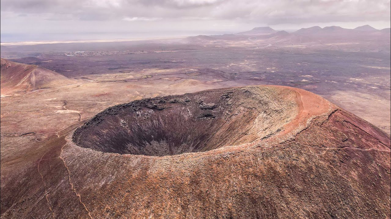
In the north of the island, in an isolated part of the municipality of La Oliva, the silhouette of the volcano known as Calderón Hondo looms on the horizon. It’s not alone: around it are several other volcanic cones which together make up what is known as the Bayuyo alignment. These volcanoes emerged simultaneously around 50,000 years ago, and their lava caused the surface area of Fuerteventura to increase northwards, bringing it closer to the neighbouring island of Lanzarote.
Because it can be reached via a large number of different paths and the incline is only moderate, access to Calderón Hondo is completely straightforward, and the ascent is one of the easiest on the island. In addition, its location between the towns of Lajares and Corralejo means that the visitor can take in other major sightseeing attractions in the north of the island, such as the Dunas de Corralejo Natural Park and the secluded fishing village of Majanicho. If you’d like to find out a little more about this hiking path and its secrets, please read on.
The Bayuyo formation, a volcanic wonder in the north of Fuerteventura
There was a time in the dim, distant past when the Canary Islands did not cover the same surface area as they do today. In the specific case of Fuerteventura (which in geological terms is considered the oldest island in the archipelago), we know that its elongated form was not always so pronounced. Fifty thousand years ago, seven points of eruption in a 5-kilometre straight line began to spew out lava, as a result of which the island’s surface area expanded by 110 square kilometres and the island of Lobos emerged. These ancient eruptions have nowadays become seasoned volcanoes making up what is now called the Bayuyo alignment—Bayuyo being a name with pre-Hispanic origins handed down from the tribes who occupied the island in ancient times. In a north-easterly to south-westerly direction, the volcanic craters of Bayuyo, Las Calderas, Caldera Encantada, Caldera Rebanada, Calderón Hondo, Montaña Colorada, Montaña de la Mancha and Montaña de Lomo Blanco (together with their lava fields) form one of northern Fuerteventura’s most remarkable landscapes.
How to get to Calderón Hondo
Of all the volcanoes mentioned above, Calderón Hondo, is not only the best preserved, but also probably the most easily accessible. It can be reached via a large number of well-signposted paths from Corralejo in the north, or from Lajares in the south. It is however from Lajares, located only 4 kilometres from the volcano, that most hikers begin the ascent. We need to find the point of departure on the outskirts of the town, right on the fork between the paved road leading to Majanicho—Calle la Cancela—and the sandy track that leads to Calderón Hondo—Camino Calderas. Once on this track, we can make our way without difficulty to the volcano, which can be clearly seen in the distance. We need to be aware that we will soon come to a second fork which, if we take the left-hand path, will enable us to ascend the western face of the volcano—or its southern face if we take the right-hand path.
The right-hand path is recommended, as it is less steep and stony. Along this path—an ascent of 2.5 kilometres, which takes 35 minutes—we will climb the southern face of Calderón Hondo, while around us we will see the increasingly spectacular views of the amazing volcanic landscape and the plain on which it is set. In addition, hikers can explore vestiges of the history of the region’s economy during their walk. There are, for example, several abandoned quarries scattered across the landscape, reminders of the role that volcanic materials historically played in the construction industry (before they were banned, of cou
Sound:
Epidemic Sound: https://share.epidemicsound.com/j3gxkn
join and get a discount!
Повторяем попытку...
Доступные форматы для скачивания:
Скачать видео
-
Информация по загрузке: