The_geographer_man
Here, you’ll find everything related to Geography, GIS, Remote Sensing, QGIS, ArcGIS, CDO, Python Coding, and much more! Whether you're a student, researcher, or professional, we offer tutorials, tips, and practical examples to help you explore spatial data analysis, digital mapping, environmental studies, and programming for geospatial applications.
Subscribe to stay updated with in-depth guides on GIS software, satellite image processing, climate data analysis, and Python scripts for automation.
Let’s make geospatial learning easy and accessible for everyone!
Instagram geoknowledge1

Vectorization in ArcGIS: Converting Raster Data to Vector Format for Enhanced Spatial Analysis"

Global carbon emission by fossil fuel reached a record high in 2024
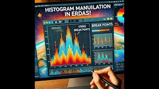
"Learn How to Manipulate Histograms in ERDAS Using Break Points /Using Breakpoint in Eras Imagine

Image to Map Georeferencing in Erdas Imagine How to Georeferencing using Gcp point in Erdas Imagine

"Mastering Map Composition: Step-by-Step Guide in QGIS Map-making in QGIS/Using Print Layout in Qis

"How to Georeferenced in ERDAS IMAGINE"//"Georeferencing in ERDAS IMAGINE Step-by-Step Guide"

Introduction to Research methodology

Symbology & Labels in Qis// Single Symbol//Categorized Symbol

georeferencing in QGIS How to Perform Georeferencing Using GCP How to do georefercing

#digitization in Google Earth Pro in line//point/polygon#victor #how to digitize in google earth pro

#digitization in QGIS in point II #vectorart II How to digitize in QGIS Phase 1 (Video 3)"

Digitization in QGIS in Line II vectorization II How to digitize in QGIS Phase 1 (Video 2)"

Digitization in QGIS in polygon II vectorization II How digitalize in QGIS