Super Technical Education
Asalam o Alikum.
My Name is Engr Bilal Ahmed.
In This Channel I Spread My Civil Engineering Knowledge Through all over the world 🌍 to Civil Engineering Students.
Here I teach the following Subjects:
1. Quantity Surveying
2. Land surveying
3. Structure Design
4. Concrete Technology
5. Construction Site Videos( Practically)
6.Auto CAD 2D,3D
7. Total Station
8. Advance Microsoft Excel
Connect with me:
WhatsApp ( for Sponsorship and Business)
+92307-8939919

How to Calculate Invert Levels & Slope. #civilengineering #slope

How to determine Height of Pole with Using Auto Level

How to Read the Surveyor E Staff (Surveying Levelling Rod) Measurements

How to Change Units in Total Station | Meter to Feet & Feet to Meter

Comparison B/w Total Station FOIF And Kolida Complete#surveying #kolida #FOIF
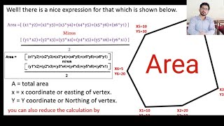
How to Calculate Land Area With Coordinates.
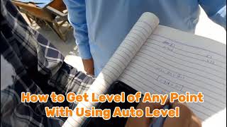
How to Get Level of Any Point with Using Auto Level

How to Shift BM/Level to Multi Story Building using Auto Level | Urdu/Hindi

Units Conversion in Civil Engineering.#conversion #unit

Slope Calculation

Constant Head Permeability Test | Procedure and Data Analysis #education #engineering #science

How to Find Moisture Content in Soil by Speedy moisture Apparatus.#soiltesting

How to Estimate Steel Quantity for Slab – Easy Method! #steel #steelstructure

I Spent 30 Days Studying FIGHTER Aircraft And Here's What Happened #aircraft #3d

Step-by-Step Tutorial: How to Convert UTM Coordinate to Local Coordinate #autocad

Resection/How to Measure New Point Coordinate with the help of Two other Points.#resectionmethod

Road Survey/How to mark Sides of Road in Civil Survey With Total Station#surveyour #road

Road Survey/ How to Mark Center Line of Road with Total Station in Civil Survey #roaddesign Part 1.

Arc Stake Out in Civil Survey with Using Total Station#supertechnicaleducation #Arcstakeout
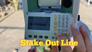
(S.O Line) How to Use Stake out Line Function on Total Station#surveying #layout
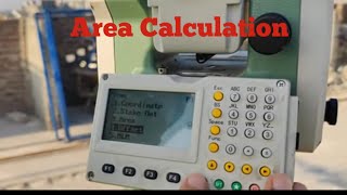
How to Measure Area of plot With Total Station#area #supertechnicaleducation

Layout Survey/ How to Use Stake out (Layout) Function on Total Station#surveying #layout

How to Use Point Projection Function On Total Station in civil Survey/#point #surveying

How to measure Height of Pole and Building. REM (Remote Elevation Measurement)

MLM/ How to Calculate Horizontal Distance Between Two points on Total Station #surveying #gps

Off Set Function Use in Total Station.#surveying #supertechnicaleducation

Understanding Road Gradients and Camber. #Camber#RoadGradients

Layout of Building with Total Station#surveying #foif

How to Use Resection and Offset Function on GPs #foif #gps

ArC Stake Out on GPS in Simple way#gps #surveying