Adlyz

QGIS Tutorial : How to Make Front-End WebGIS
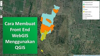
Tutorial QGIS : Cara Membuat Front-End WebGIS

ArcGIS Tutorial: How to Make a Front-End WebGIS

Tutorial ArcGIS : Cara Membuat Front-End WebGIS

ArcGIS Tutorial: How to Make Contours, Height, Slope and Hillshade (DEM Analysis)

Tutorial QGIS : Membuat Kontur, Ketinggian, Kemiringan Lereng dan Hillshade (Mengolah DEM)

QGIS Tutorial: How to Make Contours, Height, Slope and Hillshade (DEM Analysis)

QGIS Tutorial : How to make 3D map

Tutorial QGIS : Membuat Peta 3 Dimensi

Tutorial ArcGIS : Membuat Peta 3 Dimensi

ArcGIS Tutorial : How to make 3D map

Tutorial ArcGIS : Membuat Kontur, Ketinggian, Kemiringan Lereng dan Hillshade (Mengolah DEM)

QGIS Tutorial: Creating a Rainfall Map (Interpolation Analysis)

ArcGIS Tutorial : How to make a Rainfall Map (Interpolation)

Tutorial QGIS : Membuat Peta Curah Hujan (Analisis Interpolasi)

Tutorial ArcGIS : Membuat Peta Curah Hujan (Analisis Interpolasi)

QGIS Tutorial : How To Make a Radius/Buffer Zone

Tutorial QGIS : Membuat Radius/Buffer Zone

ArcGIS Tutorial : Make a Radius/Buffer Zone

Tutorial ArcGIS : Membuat Radius/Buffer Zone

Google Earth Engine : Calculate Temperature From Landsat Satellite Image (Land Surface Temperature)

Google Earth Engine : Menghitung Suhu dari Citra Satelit Landsat (Land Surface Temperature)

QGIS Tutorial: Clip, Calculate Area and Perimeter of SHP

Tutorial QGIS : Clip, Menghitung Luas dan Keliling SHP

ArcGIS Tutorial: Clip, Calculate Area and Perimeter of SHP

Tutorial ArcGIS : Clip, Menghitung Luas dan Keliling SHP

QGIS Tutorial : How to make spatial data shp (digitation, and split)

Tutorial QGIS : Membuat Data Spasial SHP (Digitasi, dan Split)

ArcGIS Tutorial : How To Make Spatial Data SHP Using ArcGIS (Digitation, Move, and Split)

Tutorial ArcGIS : Cara Merubah Peta Analog Menjadi Data Digital (Georeferencing)